Golden Pipeline
A time capsule of water,
gold & Western Australia
A project from the National Trust of WA
A self-guided drive trail between the Perth Hills and Western Australia’s Eastern Goldfields. Go with the Flow. Follow the water to discover more about the audacious goldfields water supply scheme and Engineer CY O’Connor.
“Future generations, I am quite certain will think of us and bless us for our far seeing patriotism, and it will be said of us, as Isaiah said of old, ‘They made a way in the wilderness, and rivers in the desert”
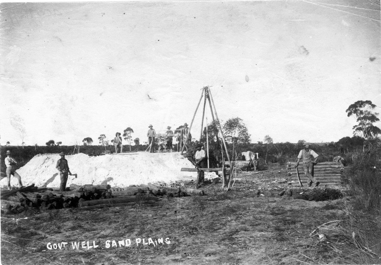
Sand Plain
Vera Whittington writes in Gold and Typhoid: two fevers that teamsters found the pull over the sandplain ‘hell’ in summer:
Usually they travelled two or thee together over the most dreaded section called ‘Devil’s Pinch’ where traffic progressed at a crawl. Often wheels sank axle deep in the sand and they were glad of help when wagons had to be dug out.
A New Zealand prospector, John Aspinall, mentioned this same Devil’s Pinch, encountered after leaving Woolgangie, in his diary.
The road is far more hilly at this place than any part of the track yet passed – one steep piece being called the Devils Pinch, where there are condensers and 2 miles further Govt condensers. We had dinner at the first place and reached Bulla Bulling after a 10 mile walk.
There are several accounts of passengers having to get out and push the coach on which they were travelling over sandy sections.
Explore
Click on any map section or place below to discover The Golden Pipeline.
Northam to Cunderdin
Explore section two