Golden Pipeline
A time capsule of water,
gold & Western Australia
A project from the National Trust of WA
A self-guided drive trail between the Perth Hills and Western Australia’s Eastern Goldfields. Go with the Flow. Follow the water to discover more about the audacious goldfields water supply scheme and Engineer CY O’Connor.
“Future generations, I am quite certain will think of us and bless us for our far seeing patriotism, and it will be said of us, as Isaiah said of old, ‘They made a way in the wilderness, and rivers in the desert”
Yerbillon to Ghooli See & Do Hunt's Well
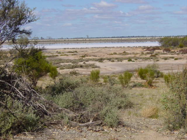
Hunt’s Well & Lake Koorkoordine
One of Hunt’s wells is located 7 km north of Southern Cross at the base of a granite outcrop near Lake Koorkoordine.
When constructed the well was 10 ft (3 m) in diameter and 10 ft (3 m) deep. It was said to be capable of supplying 10 bullocks, 10 horses, and 15 men for a month.
Around the lake, water and wind erosion have created a number of miniature caves, cliffs and bays.
You can view the Shire of Yilgarn’s location map here
Explore
Click on any map section or place below to discover The Golden Pipeline.
Northam to Cunderdin
Explore section two