Golden Pipeline


A time capsule of water,
gold & Western Australia
A project from the National Trust of WA

A self-guided drive trail between the Perth Hills and Western Australia’s Eastern Goldfields. Go with the Flow. Follow the water to discover more about the audacious goldfields water supply scheme and Engineer CY O’Connor.
“Future generations, I am quite certain will think of us and bless us for our far seeing patriotism, and it will be said of us, as Isaiah said of old, ‘They made a way in the wilderness, and rivers in the desert”
Sawyers Valley
Sawyers Valley predates Mundaring but it is the younger European settlement that became the administrative and commercial centre of the Shire of Mundaring. Is this because of a decision relating to the water supply scheme?
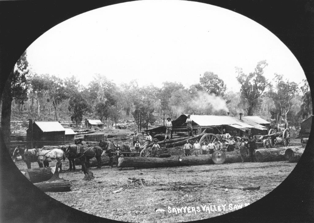
One of the earliest communities in the area, Sawyers began life in the 1860s as a settlement of tough, often former convict, pit sawyers, as the name implies. Some members of this loosely knit group were self-employed in cutting shingles for roofs in the valley.

The present village’s recreation ground is named for convict Lot Leather who owned a store and pub alongside. Leather was sentenced to ten years transportation for shooting with intent and arrived on the Clyde in 1863. He was one of the first to obtain freehold land in the area and, when the Eastern Railway was under construction, he opened a small store adjacent to his house to cater for the navvies and sawyers.
He was suspected of selling sly grog from the shop, but nothing could ever be proved. On one occasion the police ripped up the flooring of the store to find nothing, much to the amusement of the railway workers. A few years later Leather established a hotel and, miraculously, sly grog sales came to an end. Leather’s hotel was the forerunner of the 1930s current Art Deco hotel on the same site.
The construction of the Eastern Railway gave the area a boost, sawmills were established and the settlement grew into a town with a school. The old schoolhouse is used today to teach children about schooling in the past. Originally the spurline to the site of the storage reservoir for the goldfields water supply was planned in the late 1890s to run from Sawyers Valley. A better route was found at what became Mundaring and perhaps that is why ‘Sawyers’, as it is affectionately known, has remained a small township.
Explore
Click on any map section or place below to discover The Golden Pipeline.
Northam to Cunderdin
Explore section two


