Golden Pipeline
A time capsule of water,
gold & Western Australia
A project from the National Trust of WA
A self-guided drive trail between the Perth Hills and Western Australia’s Eastern Goldfields. Go with the Flow. Follow the water to discover more about the audacious goldfields water supply scheme and Engineer CY O’Connor.
“Future generations, I am quite certain will think of us and bless us for our far seeing patriotism, and it will be said of us, as Isaiah said of old, ‘They made a way in the wilderness, and rivers in the desert”
Mundaring to Cunderdin GPHT Sites
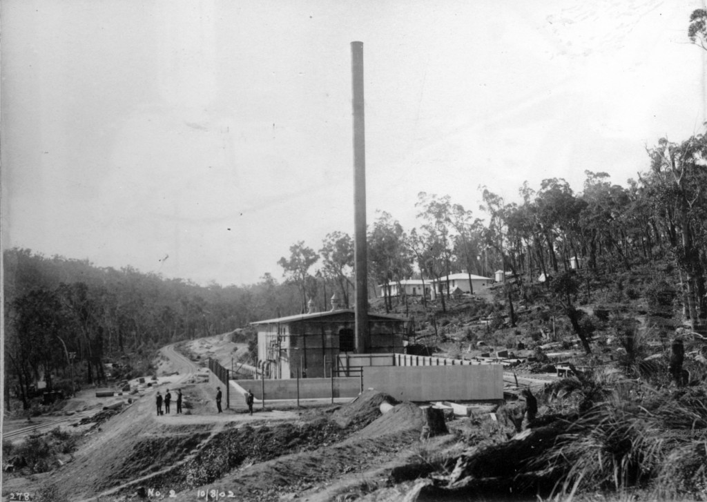
No 2 Pump Station
By 1900 the general location of each of the eight Pumping Stations necessary to lift water from the hills outside Perth to the goldfields had been decided, with the exception of No 2.
The site of No 2 Pump Station was agonised over, probably because of the hilly terrain and the clayey soil. But a decision had to be made because two pumping stations were required to lift the water over the Darling Range.

In the end the hilly site chosen was fairly constricted so the suction tank and station were placed in line rather than the tank to one side of the station building as in other stations, which was more desirable in engineering terms.
But, engineering aside, No 2 Pump Station, completed in 1902, was probably situated in the most picturesque place of all the pumping station sites on the Goldfields Water Supply Scheme.
Bill Cutler who grew up there described his childhood as ‘idyllic’. He recalls playing in the air raid shelter built during World War 11 when a Japanese invasion was expected and the water supply scheme was seen as a particular target. On another occasion he recalls pushing a trolley used to cart firewood to the pumping station along the track to the weir. Being all downhill it quickly picked up speed.
Having water in abundance, the residents of No 2 made the most of their gardens and they made a charming and unexpected site for those travelling on the spurline to the weir from Mundaring. Another resident, Winifred Lundy, recalled swinging from the Norfolk pine trees planted along the railway line.
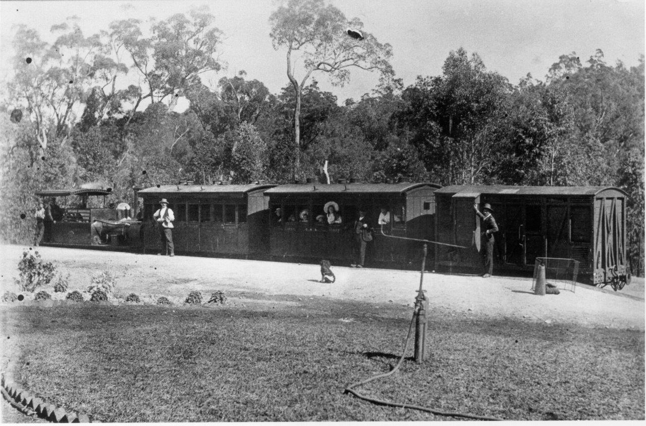
In 1927, the railway platform adjacent to the No. 2 Pumping Station was named O’Connor in memory of Charles Yelverton O’Connor, the State’s Engineer-In-Chief who designed the water supply scheme.
No 2 Pump Station ceased operating in 1956 as the conversion of the engines at the pumping stations to electricity made the No 2 Pump Station redundant. In 1968 the pump station building, weighbridge and other outbuildings associated with the place were demolished. Currently around concrete tank surrounded by a wire mesh fence is located directly on the pump station foundations.
Today the site comprises the remains of footings and floor slabs of several buildings and includes the concrete suction tank supported by dry rubble backing and earth filling, including drainage, pipe work and access stairs.
As at other pumping stations, the tank acted as a receiving reservoir for water pumped from No 1 and the No 2 pumps then drew their water from here. But this one was a little different. From October 1910 quicklime slaked with water was fed into this suction tank in an attempt to prevent internal corrosion of the pipes. The desired solution was about 4 grains of free lime per gallon of water. By June 1913 a special settling tank at No 1 was completed and lime treatment was moved down the hill. The lime treatment tank an important part of the deareation process is still in situ alongside No 1.
Weather permitting, you can enjoy a pleasant walk along railway reserve and through forest from Mundaring Weir to the site of No 2, since it is only 2.5 km from No 1. Although No 2 has been demolished, illustrated signs give an insight into how it operated. The site features on two Golden Pipeline recreational trails – the O’Connor Trail and Kep Track.
Explore
Click on any map section or place below to discover The Golden Pipeline.
Northam to Cunderdin
Explore section two