Golden Pipeline
A time capsule of water,
gold & Western Australia
A project from the National Trust of WA
A self-guided drive trail between the Perth Hills and Western Australia’s Eastern Goldfields. Go with the Flow. Follow the water to discover more about the audacious goldfields water supply scheme and Engineer CY O’Connor.
“Future generations, I am quite certain will think of us and bless us for our far seeing patriotism, and it will be said of us, as Isaiah said of old, ‘They made a way in the wilderness, and rivers in the desert”
Merredin to Yerbillon See & Do
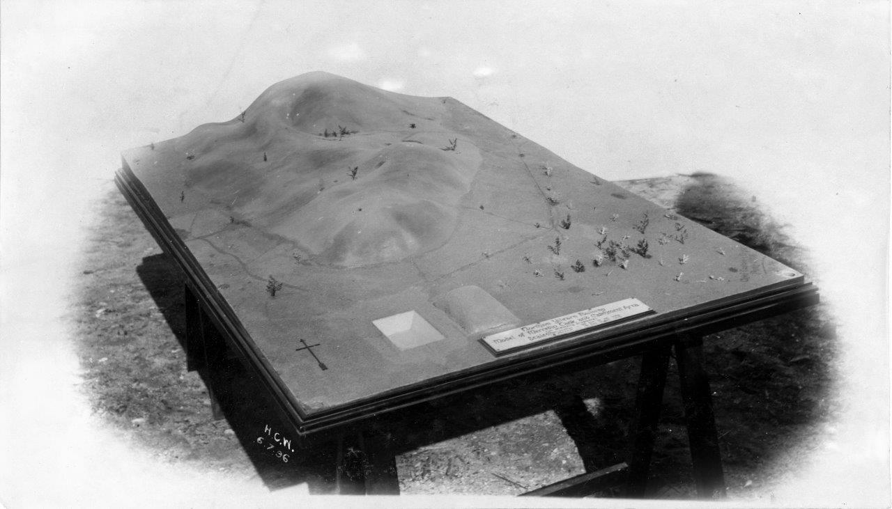
Burracoppin Railway Dam
Great Eastern Highway nowadays serves the purpose of helping you appreciate how the railway line once ran through the townsite of Burracoppin. As you approach the site the railway dam is on the outskirts to the left while the former hotel on the right faces what was the railway reserve where travellers alighted.
Burracoppin is still a stop on the Prospector’s route but the rail line was rerouted north of the settlement with the advent of standard gauge railways.
The impressive granite outcrop from which runoff from rain was channelled into the tank, or dam, was recorded in 1864 as Burancooping Rock and sometimes Lansdowne Hill.
The area around the dam has been disturbed with many tracks but stone ruins there tell a story. They are the remains of a caretaker’s cottage and as such are rather unique – the railway dam caretaker’s cottage at Merredin was demolished, for instance, but luckily Cunderdin retained theirs and nowadays it was used as storage by the golf club.
The Burracoppin ruins are a reminder about the importance of water on the road to the goldfields – so precious were sources that the government appointed caretakers to live on site. Their duties included making sure animals and people did not foul the water i.e. that they camped where no runoff from the campsite could pollute the dam. Caretakers were responsible for charging members of the public for water for human consumption as well as that for their animals.
Explore
Click on any map section or place below to discover The Golden Pipeline.
Northam to Cunderdin
Explore section two